D-59-0020
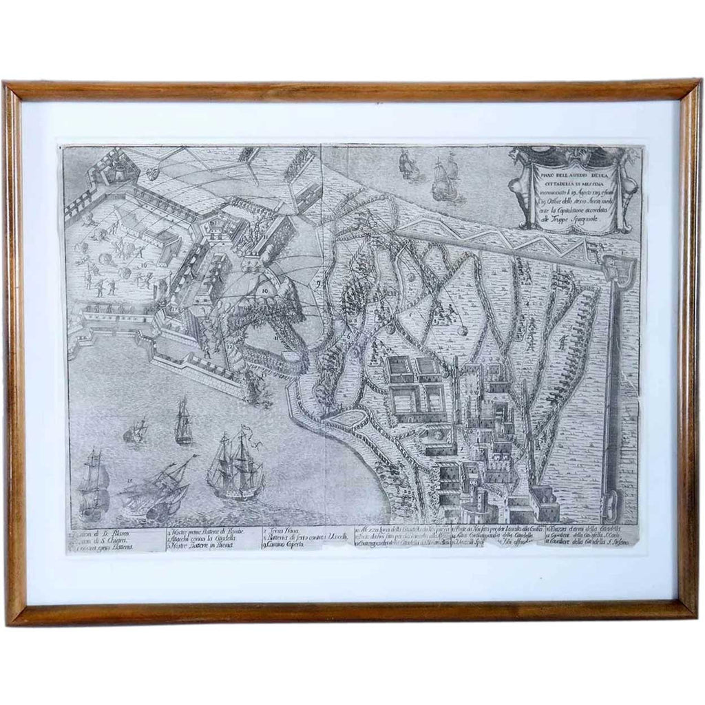
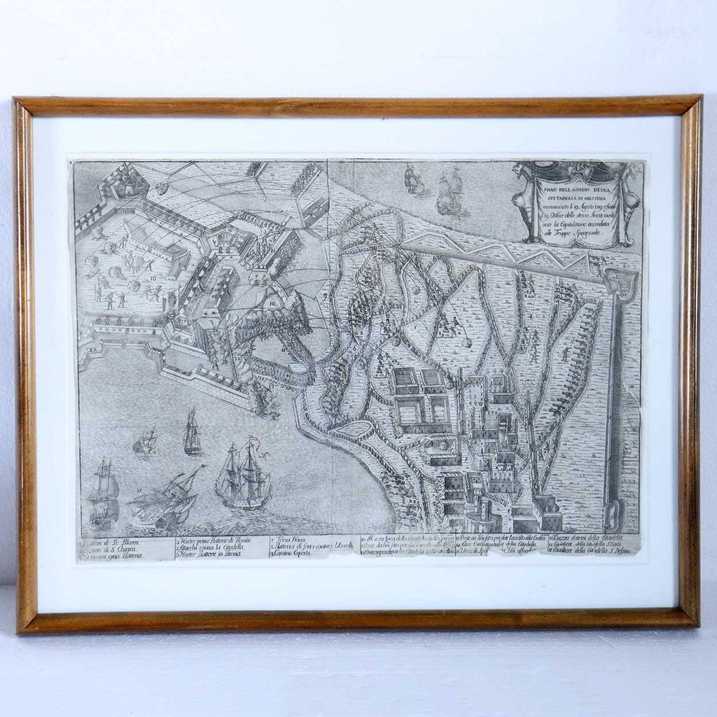
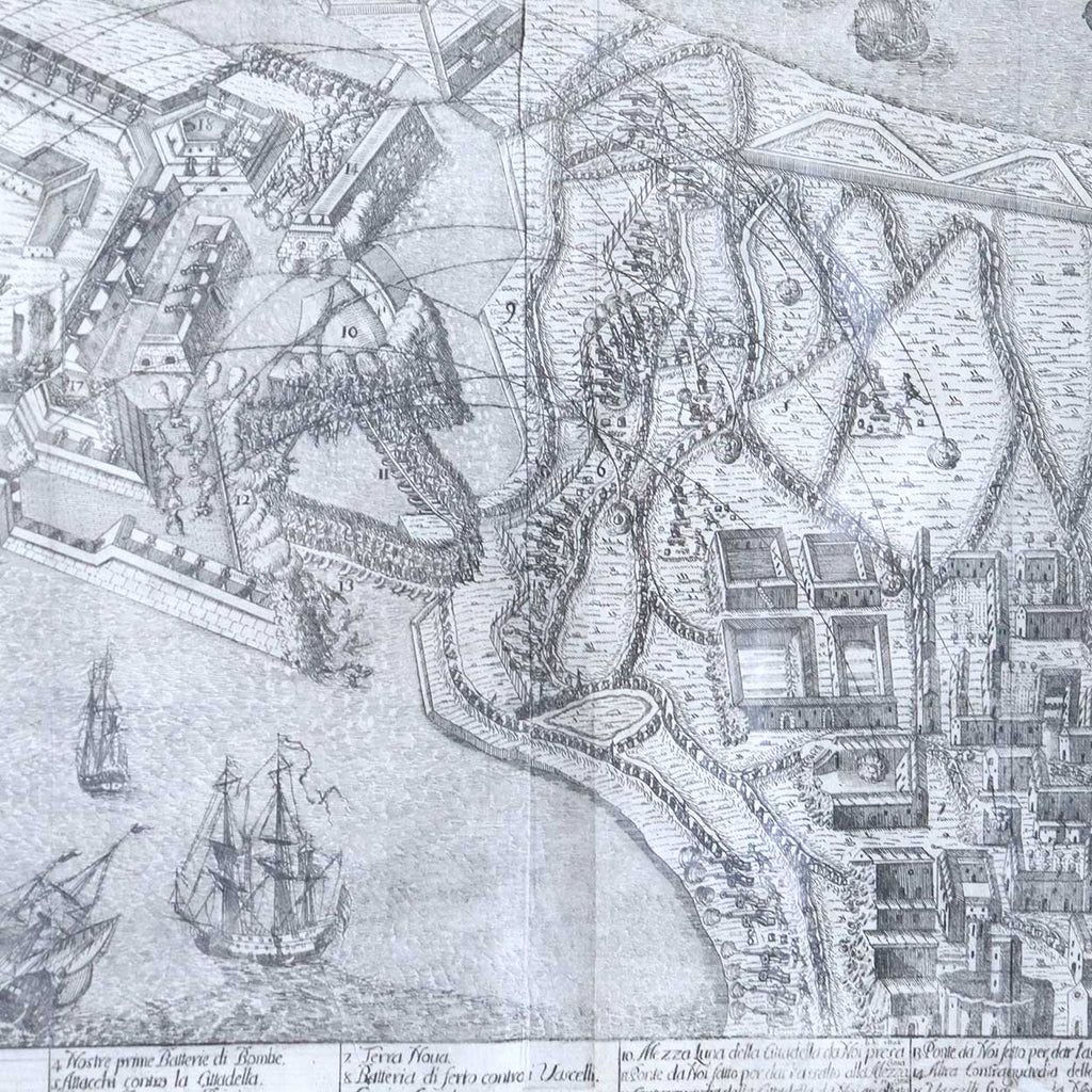
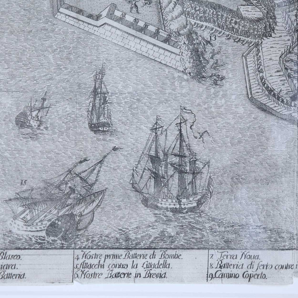
FRANCESCO CICHE Engraving, Map and Plan of the Siege of the Citadel of Messina
$1,250.00 $400.00
DETAILS
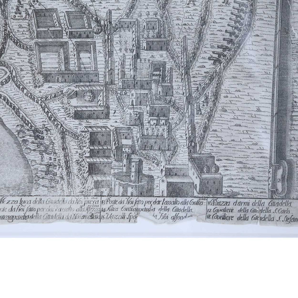
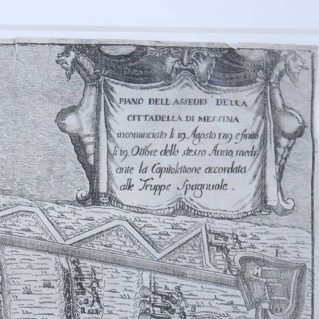
An antique 18th century engraving. This fort in Messina, Sicily was built from 1680 to 1686 by the Spanish Empire.
TITLE
Piano dell'Assedio della Cittadella di Messina incominciato li 19 Agosto 1719 e finito li 19 Ottobre dello stesso Anno mediante la Capitolatione accordata alle Truppe Spagnuole
FRAMING
Matted and framed
MAKER
Francesco Ciché (Italian, circa 1690-1742), active 1707-42
PERIOD
Early 18th century
DATE
Circa 1721
DIMENSIONS
Width 18 Depth 1 Height 14 inches
Sight: Width 15 Height 10.5 inches


